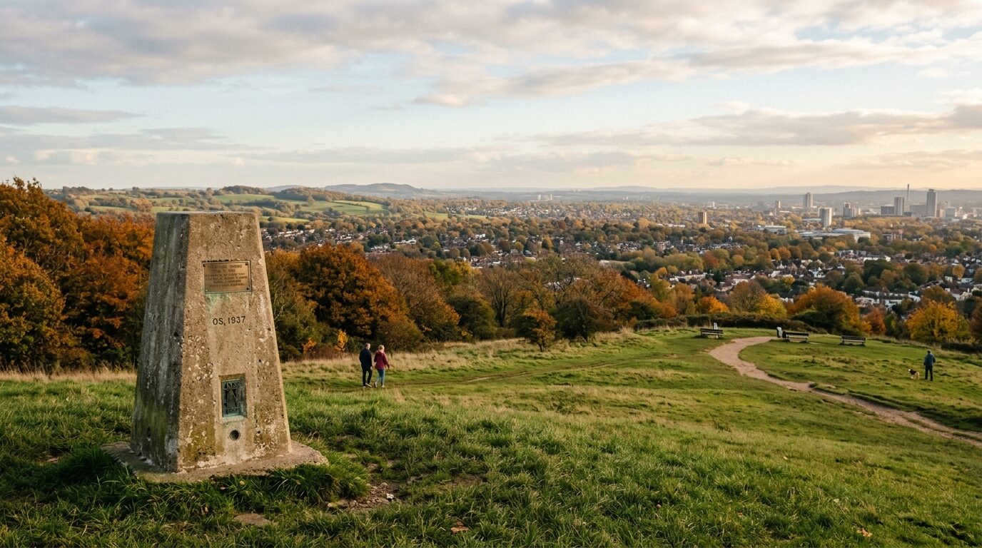
Rising abruptly 65 metres above sea level on the southwestern ridge of Norbury, Pollards Hill commands one of the most expansive and unexpected panoramas in South London. Standing on its crest, visitors can take in an uninterrupted 180-degree sweep looking across northern Croydon, the former Waddon Marsh power station landmarks, and out towards the distant rolling ridgeline of the North Downs in Surrey.
While generations of SW16 walkers, families, and runners frequent its grassy recreation ground daily, few know that its open crown was saved by a generous civic gift more than a century ago—or that it preserves one of Greater London’s increasingly rare surviving Ordnance Survey triangulation pillars.
The Civic Gift of Sir Frederick Edridge
At the close of the nineteenth century, suburban growth surged southward along London Road from Streatham into Norbury. Speculative residential building rapidly enveloped the surrounding farmland, establishing wide avenues of family homes such as Pollards Hill South, North, and East.
Recognising that the dramatic hilltop summit would be lost to private development if left unprotected, Sir Frederick Edridge—a prominent local philanthropist and five-time Mayor of Croydon—stepped in. In 1913, Sir Frederick purchased the summit grounds and formally gifted the land to Croydon Corporation to remain an open public park in perpetuity. His civic generosity ensured that the community would permanently retain public access to the fresh air and expansive southern skyline.
A Historic Ordnance Survey Triangulation Pillar
Positioned directly on the summit lawn stands pillar TP5488, a solid concrete Ordnance Survey “trig point.” Erected as part of the Retriangulation of Great Britain initiated in 1936 by Major Martin Hotine, these iconic pillars allowed cartographers to accurately map the nation using precise line-of-sight theodolite measurements.
While thousands of trig pillars were set upon rugged moorlands and Scottish peaks, only a tiny handful survive within the built-up confines of Greater London. The pillar at Pollards Hill stands as a tangible piece of twentieth-century British cartographic history, maintaining its high vantage point across the capital’s southern basin.
Community Care and the Toposcope Pedestal
Beside the trig point, visitors will find a bronze and stone toposcope viewing pedestal, erected through the efforts of the Pollards Hill Residents’ Association. The direction dial points out key geographical landmarks visible across the horizon—from Croydon Clocktower and the Surrey Hills to distant points of interest.
The open recreation ground is also bounded by intriguing geography: down its western flank lies Ena Road, recognized by London geographers as one of the capital’s steepest residential inclines. A historic municipal boundary separates Croydon’s leafy hillside from the lower meadows and 1970s housing estates of Merton below, making the hilltop a unique crossroads of suburban landscape and heritage.
Visiting Pollards Hill: Practical Resident Guide
- Location: Pollards Hill Recreation Ground, Pollards Hill North / Beech Road, Norbury SW16.
- Facilities: Open grassy slopes, viewing pedestal, benches, children's play area, and walking trails.
- Getting There: Located approximately 12 to 15 minutes' walk up the hill from Norbury National Rail Station; accessible via local bus routes 50, 109, and 255 along London Road.
- Walking Tip: The ascent via Beech Road or Pollards Hill South offers gentle paved gradients, while paths climbing from the Merton boundary provide a brisk workout.
Whether stopping by during a weekend autumn stroll or climbing the hill for sunset over the Surrey downs, Pollards Hill remains one of Norbury's finest open-air civic treasures—where century-old local history meets London’s natural horizon.